You Are Not Alone - MATES Cafe Hamilton NZ
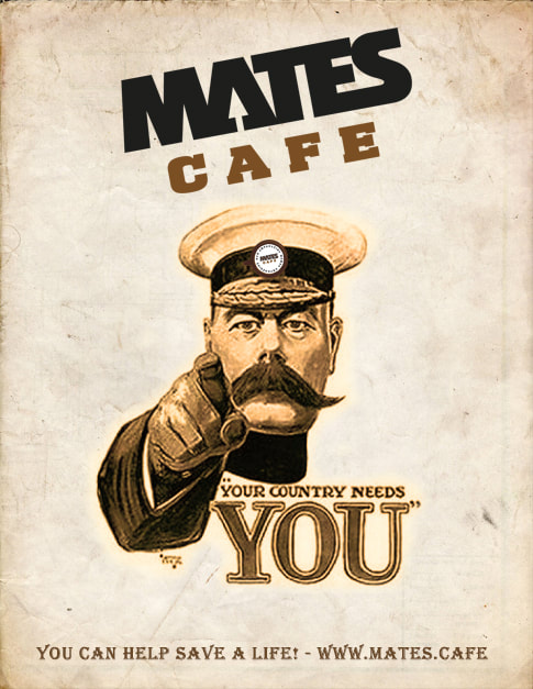
MATES Cafe is a network of everyday people of all cultures and ethnicity (including teens, elders and lgbt+) who are trained to meet with a person in crisis or isolation at a local cafe, and provide emotional support and encouragement.
|
|
|

MATES Cafe will empower your life so you can in turn empower the lives of others in need.
MATES are here:
To help people of all ages, gender, culture, ethnicity and personal beliefs through the challenges and tough times of life including relationship breakdown, depression, anxiety, loss and grief, bullying, loneliness and isolation. MATES are trained to be there for someone in need and helping them through a point of crisis in their life. It's not about therapy, fixing or giving advice, just simply listening and helping them to find new direction in their life.
Hamilton NZ - MATES Cafe Network
|
A Call-Out to ALL!
Can You Spare ONE Hour of Your Life to Save a Life? MATES Cafe is purely about saving lives. Do you realise one person completes suicide every 13 hours in New Zealand because they are unable to stand the emotional trauma they are undergoing, often caused by relationship breakdown. Every 4 minutes 1 New Zealander has suicidal thoughts and needs a MATE to turn to. MATES need your help to drastically lower the suicide rate... are you with us? Saving someones life can be to either:

|
About Hamilton
Hamilton (Māori: Kirikiriroa) is the seat and most populous city of the Waikato Region, in the North Island of New Zealand.
The city encompasses a land area of about 98 km2 (38 sq mi) on the banks of the Waikato River, and is home to 150,200 people,[3] making it New Zealand's fourth most-populous city. Hamilton City is part of the wider Hamilton Urban Area, which also encompasses the nearby towns of Ngaruawahia, Te Awamutu and Cambridge.
Initially an agricultural service centre, Hamilton now has a growing and diverse economy and is the third fastest growing urban area in New Zealand (behind Pukekohe and Auckland).[4] Education and research and development play an important part in Hamilton's economy, as the city is home to approximately 40,000 tertiary students and 1,000 PhD-qualified scientists.[5]
History Victoria Bridge in 1910. The area now covered by the city was originally the site of a handful of Māori villages (kāinga), including Pukete, Miropiko and Kirikiriroa ("long stretch of gravel'), from which the city takes its Māori name. Local Māori were the target of raids by Ngāpuhi during the Musket Wars,[6] and several pā sites from this period can still be found beside the Waikato River.In December 2011 several rua or food storage pits were found near the Waikato River bank, close to the Waikato museum. Magistrate Gorst, estimated that Kirikiriroa had a population of about 78 before the Waikato Kingitanga wars of 1863–64. The government estimated the Waikato area had a Maori population of 3,400 at the same time. By the time British settlers arrived after 1863, most of these villages had been abandoned as the inhabitants were away fighting with the Kingitanga rebels further west in the battlefields of the upper Waipa river. Missionaries arrived in the area in the 1830s.[7] At the end of the Waikato Campaign in the New Zealand wars the four regiments of the Waikato Militia were settled as a peace-keeping force across the region.[7] The 1st Regiment was at Tauranga, the 2nd at Pirongia, the 3rd at Cambridge and the 4th at Kirikiriroa.[7][8] The settlement was founded on 24 August 1864 and named by Colonel William Moule after Captain John Fane Charles Hamilton,[9] the popular Scottish commander of HMS Esk, who was killed in the battle of Gate Pā, Tauranga. Many of the soldier/settlers who intended to farm after the 1863 war, walked off their land in 1868 disgusted at the poor quality of the land. Much of the land was swampy or under water. In 1868 Hamilton's population, which was about 1,000 in 1864, dropped to 300 as farmers left.[10]
The road from Auckland reached Hamilton in 1867 and the railway in December 1877. That same month, the towns of Hamilton West and Hamilton East merged under a single borough council.[11] The first traffic bridge between Hamilton West and Hamilton East, known as the Union Bridge, opened in 1879. It was replaced by the Victoria Bridge in 1910.
Hood Street in 1962. The first railway bridge, the Claudelands Bridge, was opened in 1884. It was converted to a road traffic bridge in 1965.[12] Hamilton reached 1,000 people in 1900, and the town of Frankton merged with the Hamilton Borough in 1917.[8] Between 1912 and 1936, Hamilton expanded with new land in Claudelands (1912), Maeroa (1925), and Richmond – modern day Waikato Hospital and northern Melville (1936).[13] Hamilton was proclaimed a city in 1945.[7]
The city is near the southernmost navigable reach (by the settlers steam boats) of the Waikato River, amidst New Zealand's richest and now fertile agricultural land that was once largely Raupo and Kahikatea swamp[14] Beale Cottage is an 1872 listed building in Hamilton East.
From 1985 MV Waipa Delta[15] provided excursions along the river through the town centre. In 2009 Waipa Delta[16] was moved to provide trips on Waitemata Harbour in Auckland,[17] but replaced by a smaller boat. That too ceased operation and the pontoon at Parana Park was removed in 2013.[18] The Delta moved to Taupo in 2012.[19]
On 10 March 2013 a statue was erected in honour of Captain John Charles Fane Hamilton, the man whom the city is named after.[20]
Hamilton today Hood Street in Hamilton Central. Hamilton Central, on the Waikato River, is a bustling retail precinct. The entertainment area is quite vibrant due to the large student population. The 2008 Lonely Planet guide states that "the city's main street has sprouted a sophisticated and vibrant stretch of bars and eateries that on the weekend at least leave Auckland's Viaduct Harbour for dead in the boozy fun stakes."[34] Many of the city's venues and attractions are located on the old Town Belt, including Hamilton Gardens, Waikato Stadium, Seddon Park, Founders Theatre and the Hamilton Lake Domain.
As of 2014, the city continues to grow rapidly. Development is focused on the northern end of the city although in 2012 the council made a decision to balance the city's growth by approving an urban development to the south. Traffic congestion is increasing due to population growth, though the council has undertaken many road development projects to try to keep up with the rapid growth.[35] State Highway 1 runs through the western and southern suburbs and has a major junction with State Highway 3 south of the city centre, which contributes to congestion. The Hamilton City Council is building a 2/4-lane arterial road, Wairere Drive, through the northern and eastern suburbs to form a 25 km suburban ring road with State Highway 1, which is due for completion in early 2015.,[36] while the New Zealand Transport Agency plans to complete the Hamilton section of the Waikato Expressway by 2019, easing congestion taking State Highway 1 out of the city and bypassing it to the east.[37]
The rapid growth of Hamilton has brought with it the side effects of urban sprawl especially to the north east of the city in the Rototuna area. Further development is planned in the Rototuna and Peacocke suburbs.[38] There has been significant development of lifestyle blocks adjacent to the Hamilton Urban Area, in particular Tamahere, and Matangi.
Waikato River in Hamilton Central. The landscape of Hamilton was formed by the last eruption of the Lake Taupo volcano complex 1800 years ago which sent waves of volcanic debris northwards and changed the path of the Waikato River to its present path. With the exceptions of the many low hills such as those around the University of Waikato, Hamilton Lake, Beerescourt, Sylvester Road, Pukete and to the west of the city, and an extensive network of gullies, the terrain of the city is relatively flat. In some areas such as Te Rapa, one old path of an ancient river can be traced. The relatively soft and unconsolidated soil material is still being actively eroded by rain and runoff.
Hamilton Central, from Somerset Heights. In its natural state, Hamilton and environs was very swampy in winter with many of the 30 small lakes overflowing into surrounding peat swamps. Hamilton is surrounded by 7 large peat bogs such as Komakorau to the North and Rukuhia and Moanatuatua to the South, as well as many smaller ones. The total area of peat bog is about 655km2.[39] Early photos of Hamilton East show carts buried up to their axles in thick mud. The site had about small lakes, most of which have now been drained. Up until the 1880s it was possible to row and drag a dinghy from the city to many outlying farms to the North East. This swampy, damp environment was ideal breeding ground for the TB bacillus, which was a major health hazard in the pioneering days. The first Hamilton hospital was constructed on a hill to avoid this problem. One of the reasons why population growth was so slow in Hamilton until the 1920s was the great difficulty in bridging the many arms of the deep swampy gullies that cross the city. Hamilton has 6 major dendritic gully complexes with the 15 km long, 12 branch, Kirikiriroa system being in the north of the city and the southern Mystery creek-Kaipaki gully complex being the largest.[40]
In the 1930s, Garden Place Hill, one of the many small hills sometimes referred to as the Hamilton Hills, was removed by unemployed workers working with picks and shovels and model T Ford trucks. The Western remains of the hill are retained by a large concrete wall. The original hill ran from the present Wintec site eastwards to the old post office (now casino). The earth was taken 4 km north to partly fill the Maeroa gully adjacent to the Central Baptist Church on Ulster Streat, the main road heading north.
Lake Rotoroa (Hamilton Lake) began forming about 20,000 years ago. Originally it was part of an ancient river system that was cut off by deposition material and became 2 small lakes divided by a narrow peninsula. With higher rainfall and drainage from the extensive peat land to the west, the water level rose so the narrow peninsula was drowned so forming one larger lake. To the north the lake is 8m deep and in the southern (hospital) end 6m deep. The old dividing peninsula, the start of which is still visible above water on the eastern side, is only 2m below the surface.
Hamilton is one of the few cities in the world that has a near-exact antipodal city – Córdoba, Spain.
Climate Hamilton has a temperate climate, with about 1,184 mm (46.6 in) of rainfall annually. Daily maximum temperatures range from about 22 to 26C (72–79F) in January and February to 10 to 15C (50–59F) in July and August. The highest temperature recorded in Hamilton was 34.7C (95F), and the coldest temperature of −9.9C (14F) – the lowest of the major New Zealand cities.[41]
Summer occasionally sees temperatures of more than 28 °C (82 °F), while on clear winter mornings temperatures may drop to as low as −3 °C (27 °F). Ground frosts are common and snow is possible but rare. The only recorded snowfall in modern times was light snow flakes in mid August 2011 during a prolonged cold period that saw snow fall as far north as Dargaville. Typically summers are warm and dry and winters cool and wet. On average, Hamilton sees around 2,000 hours of sunshine each year (see table below).
According to official census figures,[43] Hamilton's population is 65.3% Pākehā/European, 19.9% Māori, 10.6% Asian, 4.2% Pacific Peoples and 1.5% Middle Eastern, Latin American and African. More than 80 ethnic groups are represented within Hamilton's population. The main area of population growth is in the Flagstaff-Rototuna area. With its large tertiary student population at Wintec and Waikato University, approximately 40,000 tertiary students, Hamilton has a significant transient population.[44] Hamilton is the second fastest growing population centre after Auckland.
Government and politics Local government Hamilton is located in the administrative areas of the Hamilton City Council. The council consists of thirteen councillors and a mayor (currently Julie Hardaker), elected in 2010 and re-elected in 2013. The council has two wards (constituencies), east and west, with the boundary between the two being the Waikato River. Council elections are held every three years and most recently in October 2013.
Economy Education and research are important to the city, through the University of Waikato and the Waikato Institute of Technology (Wintec). Research at the Ruakura research centres have been responsible for much of New Zealand's innovation in agriculture. Hamilton's main revenue source is the dairy industry, due to its location in the centre of New Zealand's largest dairying area – the Waikato region.
Hamilton annually hosts the National Agricultural Fieldays at Mystery Creek, the southern hemisphere's biggest agricultural trade exhibition. Mystery Creek is the country's largest event centre and hosts other events of national importance, such as Parachute Christian music festival, the National Car Show and the National Boat Show.
Manufacturing and retail are also important to the local economy, as is the provision of health services through the Waikato Hospital. The city is home to New Zealand's largest aircraft manufacturer, Pacific Aerospace, which manufactured its 1,000th aircraft in August 2009, and Micro Aviation NZ which manufactures and exports high-quality microlight aircraft. It also has its largest concentration of trailer-boat manufacturers such as Buccaneer. Hamilton is also the home of Gallagher Group Ltd, a manufacturer and exporter of electric fencing and security systems. Employing 600 people Gallagher has been doing business in Hamilton since 1938.
Recent years have seen the firm establishment of the New Zealand base of the British flight training organisation CTC Aviation. CTC trains over one hundred airline pilots a year at its "Crew Training Centre" at Hamilton Airport.
Tainui Group Holdings Ltd, the commercial arm of the Waikato tribe, is one of Hamilton's largest property developers. The Waikato tribe is one of the city's largest landowners. Tainui owns land at The Base, Centre Place, The Warehouse Central, University of Waikato, Wintec, the Courthouse, Fairfield College, and the Ruakura AgResearch centre.[49] The Waikato tribe is a major shareholder of the Novotel Tainui and the Hotel Ibis.
It has developed the large retail centre The Base in the old Te Rapa airforce base site which was returned to Tainui, following confiscation in the 1860s, as part of a 1995 Treaty of Waitangi settlement. In mid-2010, The Base was further expanded with Te Awa Mall complex stage 1.[citation needed] Many large retailers such as Farmers and other nationwide speciality chains have located at Te Awa. In 2011 a further stage was opened, with cinemas, restaurants, shops and an underground carpark.
The city's three major covered shopping malls are Centre Place (formerly Downtown Plaza)[50] in the CBD, Westfield Chartwell and most recently Te Awa at The Base. After Farmers Hamilton moves from its existing site on corner of Alexandra and Collingwood streets into the redeveloped Centre Place in late 2013,[51] each major mall will have the department store as an anchor tenant.
The western suburb of Frankton is home to a smaller shopping centre and long-standing local furniture and home department store Forlongs.[52] There are many other small suburban shopping centres or plazas, often centred around a New World or Countdown supermarket, such as in Rototuna, Hillcrest and Glenview.
Culture Garden Place In 2004, Hamilton City Council honoured former resident Richard O'Brien with a life-size bronze statue of him as Riff Raff in his space suit, from The Rocky Horror Picture Show. The statue was designed by WETA Workshops, who had done the props for The Lord of the Rings films. It stands on the former site of the Embassy Cinema, where Richard watched science fiction-double features.[53]
Several Maori Pa have been part restored at Pukete, Hikuwai and Miropiko along the banks of the Waikato River.
The city is host to a large number of small galleries and the Waikato Museum. The latter includes Te Winika, one of the best-preserved waka (Māori war canoe) from the pre-colonisation era.
Music Hamilton is host to several large scale music festivals including the Soundscape music festival, which is one of New Zealand's largest street parties,[54][55][56] and the Parachute music festival. The city also hosts the Opus Chamber Orchestra which draws musicians from around the Waikato Region[57] and is the home of the New Zealand Chamber Soloists.[58] An ongoing classical concert series featuring world class musicians[59] is held throughout the year at the Gallagher Concert Chamber, organised by the University of Waikato, Conservatorium of Music.
Sport The local rugby union teams are Waikato (ITM Cup) and the Chiefs (Super Rugby). The local colours are red, yellow and black, and the provincial mascot is Mooloo, an anthropomorphic cow. Both teams play at Waikato Stadium. Hamilton is also home to a soccer club, Waikato FC, that competes in the ASB Premiership. The soccer club Hamilton Wanderers that competes in the Lotto Sport Italia NRFL Premier also are based in Hamilton.
Waikato Stadium, Lions vs. NZ Māori, 2005. Seddon Park (formerly Westpac Park) is Hamilton's main cricket venue and hosts Test matches and One Day Internationals. It is the home ground of the Northern Districts Cricket Association.
Hamilton is fast becoming a motorsport venue as well. A round of the WRC was held in 2006 and the annual V8 Supercars race on a street circuit started in 2008 and ended in 2012.
Sailing takes place on Hamilton lake for 9 months of the year. The Hamilton Yacht Club has its clubrooms, slipway and ramp on the western side of Lake Rotoroa. Motor boats are not allowed on the lake, with an exception of the Yacht Club rescue boats.
Each year in April, Hamilton supports the '5 Bridges' swimming challenge. The course starts in Hamilton Gardens, and continues for 6 kilometres finishing at Ann St Beach. The swim is assisted by the current, with the full distance typically covered in under an hour. The event celebrated in 71st year on 11 April 2010.[61]
Media The major daily newspaper is the Waikato Times. Weekly community newspapers include the Hamilton Press, Hamilton News and student magazine Nexus.
Local radio stations include The Breeze, Community Radio Hamilton, Contact FM. The Edge and The Rock, two of New Zealand's most popular radio stations, were originally based in Hamilton.
City facilities and attractions Hamilton Gardens is the region's most popular tourist attraction and hosts the Hamilton Gardens Summer Festival each year.The Base is New Zealand's second largest shopping centre, with over 7.5 million visitors per year to the 190 stores. Te Awa, an enclosed speciality retail mall at The Base, was awarded a silver medal by the International Council of Shopping Centres for the second-best expansion in the Asia Pacific region.[62]
Other local attractions include Hamilton Zoo, the Waikato Museum, the Hamilton Astronomical Society Observatory, the Arts Post art gallery, and the SkyCity casino. Just 20 minutes' drive away is Ngaruawahia, the location of Turangawaewae Marae and the home of Māori King Tuheitia Paki.
Hamilton has six public libraries located throughout the city with the Central Library housing the main reference and heritage collection. Hamilton City Theaters provides professional venue and event management at three theatrical venues in the city: Founders Theater, Clarence St Theater, and The Meteor theatre.
St Peter's Cathedral, built in 1916, is the Anglican cathedral in Hamilton, on Cathedral Hill at the southern end of Victoria Street. There is also St Mary's Roman Catholic cathedral on the opposite side of the river.
The Hamilton New Zealand Temple of The Church of Jesus Christ of Latter-day Saints is located in Temple View, Hamilton. It was opened along with the Church College of New Zealand, a large high school owned by the church, in the late 1950s. Both the college and the temple were built by labour missionaries. The school was closed in December 2009. Every year, the temple hosts a large Christmas lighting show which attracts large crowds from all over the country.
The Waikato River Explorer runs scenic tours of the river from the River Jetty at Hamilton Gardens. These run weekly Thursday to Sunday all through the year. There is also a weekly Wine Tasting Cruise to Mystery Creek Wines each Sunday.
Hospitals Waikato Hospital in Hamilton West. Hamilton's public hospital is Waikato Hospital with 600 beds and a staff of approximately 2,500 located between Melville and Hamilton West.[63] There are two other major private hospitals in Hamilton City; Braemar Hospital, located in the same area that Waikato Hospital is located, and Southern Cross Hospital, located in Hamilton East. A new cancer hospital is due to open in November 2010 on the previous Braemar Hospital campus. Hamilton also has a two private primary maternity hospitals, which are fully funded by the Waikato District Health Board, Waterford Birth Centre and River Ridge Birth Centre.[64]
Transport Air Hamilton International Airport serves as both a domestic and international airport. It is jointly owned by Hamilton City and neighbouring district councils. The airport is located just outside Hamilton's boundary, within the Waipa District. There are direct flights with Air New Zealand to Auckland, Christchurch, Palmerston North and Wellington, and with Sun Air to New Plymouth, Gisborne and Tauranga also there are charter flights to other destinations throughout the North Island. The airport also served as a major base for now defunct low-cost airlines Freedom Air and Kiwi Air. Virgin Australia offered three international flights a week, to and from Brisbane Airport and Sydney Airport. However, all international flights have now been discontinued, primarily due to a small market.
The airport is the base for pilot training schools and the aircraft manufacturer, Pacific Aerospace, is located at the northern end of the runway.
Cycling Hamilton has extensive cycleways which link the city center with the outlying suburbs. These cycleways consist of a mixture of dedicated cycle lanes,which are 1 metre wide strips either coloured green or with a painted outline of a cycle and mixed use cycle/walk ways which are mainly located alongside the Waikato River.[65]
Road An extensive bus network provides coverage of Hamilton City. Many routes extend radially from the central business district, while two ring routes encompass the central business district and the outer suburbs. An advert in a 1937 Railways Magazine showed 10 buses in the Buses Ltd fleet and said they met all trains at Frankton. Buses Ltd had cut its fares in 1928 to achieve a virtual monopoly by driving Green Bus Co. out of business.[66]
New Zealand's main road artery State Highway 1 runs through several of Hamilton's suburbs and connects with State Highway 3 within the city boundaries.
In January 2011 the 4 laning (from the original 2) of Wairere Drive and the Pukete Bridge began.
Bridges Fairfield Bridge, in central Hamilton. Claudlands Bridge, Waikato The six road bridges that cross the river[67] are often the focus of morning and evening traffic delays. The six road bridges within the city are (from north to south):
In addition to the road bridges within the city, the Horotiu bridge is located approximately 10 km north of the city centre and the Narrows Bridge approximately 10 km to the south. The Narrows bridge was closed for reconstruction of its piles in September 2010.[68] In Jan 2011 widening of the 1 km approach road Wairere Drive to Pukete bridge began .The bridge was expanded to 4 lanes in early 2013.
The river is also crossed by a rail bridge and a pedestrian bridge:
The original Hamilton Railway Station was a large island station, in later years with two large signalboxes, standing just north of the locomotive depot, which stood in the junction between the ECMT and NIMT. Due to the increase in rail traffic in the 1970s and the end of steam operation in the North Island in 1968 saw the old station closed and a new one opened on the site of the locomotive depot in 1975. The former Frankton South End signalbox was relocated to the Hamilton Miniature Engineers' site at Minogue Park in Te Rapa, directly opposite the new Te Rapa loco depot, while the station building ended up near Waikato University as a cafe.
Today, passenger services in Hamilton are limited to the new Northern Explorer, which replaced The Overlander in 2012. Previous services include the Kaimai Express and Geyserland Express railcars which ran to Tauranga and Rotorua (Koutu) respectively and were cancelled in 2002, and the overnight Northerner, which ceased operation in 2004 under Toll Rail. In recent years, the canopy over Platform One (NIMT) has been reduced, while Platform Two (ECMT) is only used by excursion trains.
Up until 1964, the ECMT cut across the central city and crossed what is now the Claudelands Bridge. This proved a problem with growing traffic congestion at the city level crossings, and although various plans were mooted for the lowering of the rails, this did not take place until 1964 when a new low-level line and railway bridge over the Waikato River was built.[69] As part of this, a new low level station was constructed. In later years part of this line was enclosed in a tunnel.
The Hamilton Central railway station was enclosed under the new New Zealand Railways Road Services bus terminal that was built in the late 1960s, but was later closed and the entrance blocked off with a slab of concrete. With the closure of the bus station and its demolition to make way for a new Warehouse store, the entrance was blocked up by the new foundations of the store and its underground carpark.
The station platform still exists, but access is only from the entrance of the railway tunnel. The platform and its walls have been heavily graffitied since their closure in the 1970s. It was mooted to return the station to working order for the 2011 Rugby World Cup, but this did not take place, in part due to the potential costs of restoring the station to a usable state and reopening the former blocked-up entrance-way, which was sealed when the Warehouse was completed in 2005/6.
Hamilton's rail network serves as a major hub for the distribution of dairy products to the ports of Auckland and Tauranga. This hub is located on Crawford St, on land that was formerly part of the Te Rapa Marshalling Yard, just north of the locomotive depot.
Recently there have been moves to re-introduce daily commuter train services to Auckland, with various studies supporting the economic and environmental benefits.[70] However, recent Government decisions have prioritised the completing the proposed Waikato Expressway over new train services.
The City of Hamilton also has two locomotives on display as reminders of its rail heritage:
The railway settlement From the arrival of the railway in Hamilton, Frankton was a railway town. In 1923, the suburb became even more railway-orientated when the Frankton Junction Railway House Factory opened, producing the famous George Troup designed railway houses sent to many North Island railway settlements, which are now sought-after pieces of real estate. Its 60 workers[71] produced almost 1400 pre-fabricated railway houses at a peak rate of 400 a year, using rimu and matai from the railway's central North Island forests. The sawmill also produced everything else such as signal masts and boxes, bridges, sleepers, and even furniture for railway stations. It was too efficient for private builders, who got the housing factory closed in 1929. When it finally closed in the 1990s it was very dilapidated, but NZHPT supported restoration of the Category 1 historic place, retaining original windows, big sliding doors and the saw-tooth roof.[72] It is now home to a range of businesses.[73]
Frankton also was home to the Way and Works depot, still in operation as the KiwiRail Network depot. This was connected to the main line by a short siding that ran past the factory; this line was last used in 1997 when a shunting locomotive retrieved two flat wagons from the Way and Works depot. Most of the original formation could still be seen until the realignment of Norton Road in 2011.
The railway workers' community was centred largely around the W&W depot and sawmill, containing some 200 houses and a Railways Social Hall.[74] Many of the houses are still in place, the majority being the classic 90sq2 three-bedroom design used as standard across New Zealand for railway staff.[75]
Education See also: List of schools in Waikato, New Zealand#Hamilton City Hamilton is home to more than 40,000 tertiary students, mostly enrolled in one of the city's three main tertiary institutes; the University of Waikato, Waikato Institute of Technology and Te Wananga o Aotearoa.
As well as state and private primary, intermediate and high schools, it also notably includes a number of Kura Kaupapa Māori primary schools offering education in the Māori language.
The city has six state secondary schools, in a clockwise direction from north: Fairfield College in Fairfield, Hamilton Boys' High School in Hamilton East, Hillcrest High School in Silverdale, Melville High School in Melville, Hamilton Girls' High School in the central city, and Fraser High School in Nawton. Both Boys' and Girls' High offer boarding facilities. A new state secondary school is planned for the Rototuna area to serve the booming north-eastern corner of the city. The project had been delayed several years as the current secondary school serving the area, Fairfield College, is below capacity. The new secondary school is planned to open in 2016.[76]
Additionally, Hamilton is home to a number of state-integrated and private schools. There are numerous state-integrated Catholic primary schools throughout the city. Sacred Heart Girls College and St John's College are the integrated Catholic high schools, for girls and boys respectively. Southwell School is a private co-educational Anglican primary school. Waikato Diocesan School for Girls is an integrated Anglican high school. 'Dio' is also the oldest secondary school in the city, founded in 1928.[76] St Paul's Collegiate School is a private high school for boys, also accepting girls from Year 11. All three Anglican schools are boarding and day schools. Hamilton Christian School is a private coeducational nondenominational Christian school for Years 1–13, founded in 1982.
The city encompasses a land area of about 98 km2 (38 sq mi) on the banks of the Waikato River, and is home to 150,200 people,[3] making it New Zealand's fourth most-populous city. Hamilton City is part of the wider Hamilton Urban Area, which also encompasses the nearby towns of Ngaruawahia, Te Awamutu and Cambridge.
Initially an agricultural service centre, Hamilton now has a growing and diverse economy and is the third fastest growing urban area in New Zealand (behind Pukekohe and Auckland).[4] Education and research and development play an important part in Hamilton's economy, as the city is home to approximately 40,000 tertiary students and 1,000 PhD-qualified scientists.[5]
History Victoria Bridge in 1910. The area now covered by the city was originally the site of a handful of Māori villages (kāinga), including Pukete, Miropiko and Kirikiriroa ("long stretch of gravel'), from which the city takes its Māori name. Local Māori were the target of raids by Ngāpuhi during the Musket Wars,[6] and several pā sites from this period can still be found beside the Waikato River.In December 2011 several rua or food storage pits were found near the Waikato River bank, close to the Waikato museum. Magistrate Gorst, estimated that Kirikiriroa had a population of about 78 before the Waikato Kingitanga wars of 1863–64. The government estimated the Waikato area had a Maori population of 3,400 at the same time. By the time British settlers arrived after 1863, most of these villages had been abandoned as the inhabitants were away fighting with the Kingitanga rebels further west in the battlefields of the upper Waipa river. Missionaries arrived in the area in the 1830s.[7] At the end of the Waikato Campaign in the New Zealand wars the four regiments of the Waikato Militia were settled as a peace-keeping force across the region.[7] The 1st Regiment was at Tauranga, the 2nd at Pirongia, the 3rd at Cambridge and the 4th at Kirikiriroa.[7][8] The settlement was founded on 24 August 1864 and named by Colonel William Moule after Captain John Fane Charles Hamilton,[9] the popular Scottish commander of HMS Esk, who was killed in the battle of Gate Pā, Tauranga. Many of the soldier/settlers who intended to farm after the 1863 war, walked off their land in 1868 disgusted at the poor quality of the land. Much of the land was swampy or under water. In 1868 Hamilton's population, which was about 1,000 in 1864, dropped to 300 as farmers left.[10]
The road from Auckland reached Hamilton in 1867 and the railway in December 1877. That same month, the towns of Hamilton West and Hamilton East merged under a single borough council.[11] The first traffic bridge between Hamilton West and Hamilton East, known as the Union Bridge, opened in 1879. It was replaced by the Victoria Bridge in 1910.
Hood Street in 1962. The first railway bridge, the Claudelands Bridge, was opened in 1884. It was converted to a road traffic bridge in 1965.[12] Hamilton reached 1,000 people in 1900, and the town of Frankton merged with the Hamilton Borough in 1917.[8] Between 1912 and 1936, Hamilton expanded with new land in Claudelands (1912), Maeroa (1925), and Richmond – modern day Waikato Hospital and northern Melville (1936).[13] Hamilton was proclaimed a city in 1945.[7]
The city is near the southernmost navigable reach (by the settlers steam boats) of the Waikato River, amidst New Zealand's richest and now fertile agricultural land that was once largely Raupo and Kahikatea swamp[14] Beale Cottage is an 1872 listed building in Hamilton East.
From 1985 MV Waipa Delta[15] provided excursions along the river through the town centre. In 2009 Waipa Delta[16] was moved to provide trips on Waitemata Harbour in Auckland,[17] but replaced by a smaller boat. That too ceased operation and the pontoon at Parana Park was removed in 2013.[18] The Delta moved to Taupo in 2012.[19]
On 10 March 2013 a statue was erected in honour of Captain John Charles Fane Hamilton, the man whom the city is named after.[20]
Hamilton today Hood Street in Hamilton Central. Hamilton Central, on the Waikato River, is a bustling retail precinct. The entertainment area is quite vibrant due to the large student population. The 2008 Lonely Planet guide states that "the city's main street has sprouted a sophisticated and vibrant stretch of bars and eateries that on the weekend at least leave Auckland's Viaduct Harbour for dead in the boozy fun stakes."[34] Many of the city's venues and attractions are located on the old Town Belt, including Hamilton Gardens, Waikato Stadium, Seddon Park, Founders Theatre and the Hamilton Lake Domain.
As of 2014, the city continues to grow rapidly. Development is focused on the northern end of the city although in 2012 the council made a decision to balance the city's growth by approving an urban development to the south. Traffic congestion is increasing due to population growth, though the council has undertaken many road development projects to try to keep up with the rapid growth.[35] State Highway 1 runs through the western and southern suburbs and has a major junction with State Highway 3 south of the city centre, which contributes to congestion. The Hamilton City Council is building a 2/4-lane arterial road, Wairere Drive, through the northern and eastern suburbs to form a 25 km suburban ring road with State Highway 1, which is due for completion in early 2015.,[36] while the New Zealand Transport Agency plans to complete the Hamilton section of the Waikato Expressway by 2019, easing congestion taking State Highway 1 out of the city and bypassing it to the east.[37]
The rapid growth of Hamilton has brought with it the side effects of urban sprawl especially to the north east of the city in the Rototuna area. Further development is planned in the Rototuna and Peacocke suburbs.[38] There has been significant development of lifestyle blocks adjacent to the Hamilton Urban Area, in particular Tamahere, and Matangi.
Waikato River in Hamilton Central. The landscape of Hamilton was formed by the last eruption of the Lake Taupo volcano complex 1800 years ago which sent waves of volcanic debris northwards and changed the path of the Waikato River to its present path. With the exceptions of the many low hills such as those around the University of Waikato, Hamilton Lake, Beerescourt, Sylvester Road, Pukete and to the west of the city, and an extensive network of gullies, the terrain of the city is relatively flat. In some areas such as Te Rapa, one old path of an ancient river can be traced. The relatively soft and unconsolidated soil material is still being actively eroded by rain and runoff.
Hamilton Central, from Somerset Heights. In its natural state, Hamilton and environs was very swampy in winter with many of the 30 small lakes overflowing into surrounding peat swamps. Hamilton is surrounded by 7 large peat bogs such as Komakorau to the North and Rukuhia and Moanatuatua to the South, as well as many smaller ones. The total area of peat bog is about 655km2.[39] Early photos of Hamilton East show carts buried up to their axles in thick mud. The site had about small lakes, most of which have now been drained. Up until the 1880s it was possible to row and drag a dinghy from the city to many outlying farms to the North East. This swampy, damp environment was ideal breeding ground for the TB bacillus, which was a major health hazard in the pioneering days. The first Hamilton hospital was constructed on a hill to avoid this problem. One of the reasons why population growth was so slow in Hamilton until the 1920s was the great difficulty in bridging the many arms of the deep swampy gullies that cross the city. Hamilton has 6 major dendritic gully complexes with the 15 km long, 12 branch, Kirikiriroa system being in the north of the city and the southern Mystery creek-Kaipaki gully complex being the largest.[40]
In the 1930s, Garden Place Hill, one of the many small hills sometimes referred to as the Hamilton Hills, was removed by unemployed workers working with picks and shovels and model T Ford trucks. The Western remains of the hill are retained by a large concrete wall. The original hill ran from the present Wintec site eastwards to the old post office (now casino). The earth was taken 4 km north to partly fill the Maeroa gully adjacent to the Central Baptist Church on Ulster Streat, the main road heading north.
Lake Rotoroa (Hamilton Lake) began forming about 20,000 years ago. Originally it was part of an ancient river system that was cut off by deposition material and became 2 small lakes divided by a narrow peninsula. With higher rainfall and drainage from the extensive peat land to the west, the water level rose so the narrow peninsula was drowned so forming one larger lake. To the north the lake is 8m deep and in the southern (hospital) end 6m deep. The old dividing peninsula, the start of which is still visible above water on the eastern side, is only 2m below the surface.
Hamilton is one of the few cities in the world that has a near-exact antipodal city – Córdoba, Spain.
Climate Hamilton has a temperate climate, with about 1,184 mm (46.6 in) of rainfall annually. Daily maximum temperatures range from about 22 to 26C (72–79F) in January and February to 10 to 15C (50–59F) in July and August. The highest temperature recorded in Hamilton was 34.7C (95F), and the coldest temperature of −9.9C (14F) – the lowest of the major New Zealand cities.[41]
Summer occasionally sees temperatures of more than 28 °C (82 °F), while on clear winter mornings temperatures may drop to as low as −3 °C (27 °F). Ground frosts are common and snow is possible but rare. The only recorded snowfall in modern times was light snow flakes in mid August 2011 during a prolonged cold period that saw snow fall as far north as Dargaville. Typically summers are warm and dry and winters cool and wet. On average, Hamilton sees around 2,000 hours of sunshine each year (see table below).
According to official census figures,[43] Hamilton's population is 65.3% Pākehā/European, 19.9% Māori, 10.6% Asian, 4.2% Pacific Peoples and 1.5% Middle Eastern, Latin American and African. More than 80 ethnic groups are represented within Hamilton's population. The main area of population growth is in the Flagstaff-Rototuna area. With its large tertiary student population at Wintec and Waikato University, approximately 40,000 tertiary students, Hamilton has a significant transient population.[44] Hamilton is the second fastest growing population centre after Auckland.
Government and politics Local government Hamilton is located in the administrative areas of the Hamilton City Council. The council consists of thirteen councillors and a mayor (currently Julie Hardaker), elected in 2010 and re-elected in 2013. The council has two wards (constituencies), east and west, with the boundary between the two being the Waikato River. Council elections are held every three years and most recently in October 2013.
Economy Education and research are important to the city, through the University of Waikato and the Waikato Institute of Technology (Wintec). Research at the Ruakura research centres have been responsible for much of New Zealand's innovation in agriculture. Hamilton's main revenue source is the dairy industry, due to its location in the centre of New Zealand's largest dairying area – the Waikato region.
Hamilton annually hosts the National Agricultural Fieldays at Mystery Creek, the southern hemisphere's biggest agricultural trade exhibition. Mystery Creek is the country's largest event centre and hosts other events of national importance, such as Parachute Christian music festival, the National Car Show and the National Boat Show.
Manufacturing and retail are also important to the local economy, as is the provision of health services through the Waikato Hospital. The city is home to New Zealand's largest aircraft manufacturer, Pacific Aerospace, which manufactured its 1,000th aircraft in August 2009, and Micro Aviation NZ which manufactures and exports high-quality microlight aircraft. It also has its largest concentration of trailer-boat manufacturers such as Buccaneer. Hamilton is also the home of Gallagher Group Ltd, a manufacturer and exporter of electric fencing and security systems. Employing 600 people Gallagher has been doing business in Hamilton since 1938.
Recent years have seen the firm establishment of the New Zealand base of the British flight training organisation CTC Aviation. CTC trains over one hundred airline pilots a year at its "Crew Training Centre" at Hamilton Airport.
Tainui Group Holdings Ltd, the commercial arm of the Waikato tribe, is one of Hamilton's largest property developers. The Waikato tribe is one of the city's largest landowners. Tainui owns land at The Base, Centre Place, The Warehouse Central, University of Waikato, Wintec, the Courthouse, Fairfield College, and the Ruakura AgResearch centre.[49] The Waikato tribe is a major shareholder of the Novotel Tainui and the Hotel Ibis.
It has developed the large retail centre The Base in the old Te Rapa airforce base site which was returned to Tainui, following confiscation in the 1860s, as part of a 1995 Treaty of Waitangi settlement. In mid-2010, The Base was further expanded with Te Awa Mall complex stage 1.[citation needed] Many large retailers such as Farmers and other nationwide speciality chains have located at Te Awa. In 2011 a further stage was opened, with cinemas, restaurants, shops and an underground carpark.
The city's three major covered shopping malls are Centre Place (formerly Downtown Plaza)[50] in the CBD, Westfield Chartwell and most recently Te Awa at The Base. After Farmers Hamilton moves from its existing site on corner of Alexandra and Collingwood streets into the redeveloped Centre Place in late 2013,[51] each major mall will have the department store as an anchor tenant.
The western suburb of Frankton is home to a smaller shopping centre and long-standing local furniture and home department store Forlongs.[52] There are many other small suburban shopping centres or plazas, often centred around a New World or Countdown supermarket, such as in Rototuna, Hillcrest and Glenview.
Culture Garden Place In 2004, Hamilton City Council honoured former resident Richard O'Brien with a life-size bronze statue of him as Riff Raff in his space suit, from The Rocky Horror Picture Show. The statue was designed by WETA Workshops, who had done the props for The Lord of the Rings films. It stands on the former site of the Embassy Cinema, where Richard watched science fiction-double features.[53]
Several Maori Pa have been part restored at Pukete, Hikuwai and Miropiko along the banks of the Waikato River.
The city is host to a large number of small galleries and the Waikato Museum. The latter includes Te Winika, one of the best-preserved waka (Māori war canoe) from the pre-colonisation era.
Music Hamilton is host to several large scale music festivals including the Soundscape music festival, which is one of New Zealand's largest street parties,[54][55][56] and the Parachute music festival. The city also hosts the Opus Chamber Orchestra which draws musicians from around the Waikato Region[57] and is the home of the New Zealand Chamber Soloists.[58] An ongoing classical concert series featuring world class musicians[59] is held throughout the year at the Gallagher Concert Chamber, organised by the University of Waikato, Conservatorium of Music.
Sport The local rugby union teams are Waikato (ITM Cup) and the Chiefs (Super Rugby). The local colours are red, yellow and black, and the provincial mascot is Mooloo, an anthropomorphic cow. Both teams play at Waikato Stadium. Hamilton is also home to a soccer club, Waikato FC, that competes in the ASB Premiership. The soccer club Hamilton Wanderers that competes in the Lotto Sport Italia NRFL Premier also are based in Hamilton.
Waikato Stadium, Lions vs. NZ Māori, 2005. Seddon Park (formerly Westpac Park) is Hamilton's main cricket venue and hosts Test matches and One Day Internationals. It is the home ground of the Northern Districts Cricket Association.
Hamilton is fast becoming a motorsport venue as well. A round of the WRC was held in 2006 and the annual V8 Supercars race on a street circuit started in 2008 and ended in 2012.
Sailing takes place on Hamilton lake for 9 months of the year. The Hamilton Yacht Club has its clubrooms, slipway and ramp on the western side of Lake Rotoroa. Motor boats are not allowed on the lake, with an exception of the Yacht Club rescue boats.
Each year in April, Hamilton supports the '5 Bridges' swimming challenge. The course starts in Hamilton Gardens, and continues for 6 kilometres finishing at Ann St Beach. The swim is assisted by the current, with the full distance typically covered in under an hour. The event celebrated in 71st year on 11 April 2010.[61]
Media The major daily newspaper is the Waikato Times. Weekly community newspapers include the Hamilton Press, Hamilton News and student magazine Nexus.
Local radio stations include The Breeze, Community Radio Hamilton, Contact FM. The Edge and The Rock, two of New Zealand's most popular radio stations, were originally based in Hamilton.
City facilities and attractions Hamilton Gardens is the region's most popular tourist attraction and hosts the Hamilton Gardens Summer Festival each year.The Base is New Zealand's second largest shopping centre, with over 7.5 million visitors per year to the 190 stores. Te Awa, an enclosed speciality retail mall at The Base, was awarded a silver medal by the International Council of Shopping Centres for the second-best expansion in the Asia Pacific region.[62]
Other local attractions include Hamilton Zoo, the Waikato Museum, the Hamilton Astronomical Society Observatory, the Arts Post art gallery, and the SkyCity casino. Just 20 minutes' drive away is Ngaruawahia, the location of Turangawaewae Marae and the home of Māori King Tuheitia Paki.
Hamilton has six public libraries located throughout the city with the Central Library housing the main reference and heritage collection. Hamilton City Theaters provides professional venue and event management at three theatrical venues in the city: Founders Theater, Clarence St Theater, and The Meteor theatre.
St Peter's Cathedral, built in 1916, is the Anglican cathedral in Hamilton, on Cathedral Hill at the southern end of Victoria Street. There is also St Mary's Roman Catholic cathedral on the opposite side of the river.
The Hamilton New Zealand Temple of The Church of Jesus Christ of Latter-day Saints is located in Temple View, Hamilton. It was opened along with the Church College of New Zealand, a large high school owned by the church, in the late 1950s. Both the college and the temple were built by labour missionaries. The school was closed in December 2009. Every year, the temple hosts a large Christmas lighting show which attracts large crowds from all over the country.
The Waikato River Explorer runs scenic tours of the river from the River Jetty at Hamilton Gardens. These run weekly Thursday to Sunday all through the year. There is also a weekly Wine Tasting Cruise to Mystery Creek Wines each Sunday.
Hospitals Waikato Hospital in Hamilton West. Hamilton's public hospital is Waikato Hospital with 600 beds and a staff of approximately 2,500 located between Melville and Hamilton West.[63] There are two other major private hospitals in Hamilton City; Braemar Hospital, located in the same area that Waikato Hospital is located, and Southern Cross Hospital, located in Hamilton East. A new cancer hospital is due to open in November 2010 on the previous Braemar Hospital campus. Hamilton also has a two private primary maternity hospitals, which are fully funded by the Waikato District Health Board, Waterford Birth Centre and River Ridge Birth Centre.[64]
Transport Air Hamilton International Airport serves as both a domestic and international airport. It is jointly owned by Hamilton City and neighbouring district councils. The airport is located just outside Hamilton's boundary, within the Waipa District. There are direct flights with Air New Zealand to Auckland, Christchurch, Palmerston North and Wellington, and with Sun Air to New Plymouth, Gisborne and Tauranga also there are charter flights to other destinations throughout the North Island. The airport also served as a major base for now defunct low-cost airlines Freedom Air and Kiwi Air. Virgin Australia offered three international flights a week, to and from Brisbane Airport and Sydney Airport. However, all international flights have now been discontinued, primarily due to a small market.
The airport is the base for pilot training schools and the aircraft manufacturer, Pacific Aerospace, is located at the northern end of the runway.
Cycling Hamilton has extensive cycleways which link the city center with the outlying suburbs. These cycleways consist of a mixture of dedicated cycle lanes,which are 1 metre wide strips either coloured green or with a painted outline of a cycle and mixed use cycle/walk ways which are mainly located alongside the Waikato River.[65]
Road An extensive bus network provides coverage of Hamilton City. Many routes extend radially from the central business district, while two ring routes encompass the central business district and the outer suburbs. An advert in a 1937 Railways Magazine showed 10 buses in the Buses Ltd fleet and said they met all trains at Frankton. Buses Ltd had cut its fares in 1928 to achieve a virtual monopoly by driving Green Bus Co. out of business.[66]
New Zealand's main road artery State Highway 1 runs through several of Hamilton's suburbs and connects with State Highway 3 within the city boundaries.
In January 2011 the 4 laning (from the original 2) of Wairere Drive and the Pukete Bridge began.
Bridges Fairfield Bridge, in central Hamilton. Claudlands Bridge, Waikato The six road bridges that cross the river[67] are often the focus of morning and evening traffic delays. The six road bridges within the city are (from north to south):
In addition to the road bridges within the city, the Horotiu bridge is located approximately 10 km north of the city centre and the Narrows Bridge approximately 10 km to the south. The Narrows bridge was closed for reconstruction of its piles in September 2010.[68] In Jan 2011 widening of the 1 km approach road Wairere Drive to Pukete bridge began .The bridge was expanded to 4 lanes in early 2013.
The river is also crossed by a rail bridge and a pedestrian bridge:
- Claudelands Rail Bridge
- Flagstaff Pedestrian Bridge
The original Hamilton Railway Station was a large island station, in later years with two large signalboxes, standing just north of the locomotive depot, which stood in the junction between the ECMT and NIMT. Due to the increase in rail traffic in the 1970s and the end of steam operation in the North Island in 1968 saw the old station closed and a new one opened on the site of the locomotive depot in 1975. The former Frankton South End signalbox was relocated to the Hamilton Miniature Engineers' site at Minogue Park in Te Rapa, directly opposite the new Te Rapa loco depot, while the station building ended up near Waikato University as a cafe.
Today, passenger services in Hamilton are limited to the new Northern Explorer, which replaced The Overlander in 2012. Previous services include the Kaimai Express and Geyserland Express railcars which ran to Tauranga and Rotorua (Koutu) respectively and were cancelled in 2002, and the overnight Northerner, which ceased operation in 2004 under Toll Rail. In recent years, the canopy over Platform One (NIMT) has been reduced, while Platform Two (ECMT) is only used by excursion trains.
Up until 1964, the ECMT cut across the central city and crossed what is now the Claudelands Bridge. This proved a problem with growing traffic congestion at the city level crossings, and although various plans were mooted for the lowering of the rails, this did not take place until 1964 when a new low-level line and railway bridge over the Waikato River was built.[69] As part of this, a new low level station was constructed. In later years part of this line was enclosed in a tunnel.
The Hamilton Central railway station was enclosed under the new New Zealand Railways Road Services bus terminal that was built in the late 1960s, but was later closed and the entrance blocked off with a slab of concrete. With the closure of the bus station and its demolition to make way for a new Warehouse store, the entrance was blocked up by the new foundations of the store and its underground carpark.
The station platform still exists, but access is only from the entrance of the railway tunnel. The platform and its walls have been heavily graffitied since their closure in the 1970s. It was mooted to return the station to working order for the 2011 Rugby World Cup, but this did not take place, in part due to the potential costs of restoring the station to a usable state and reopening the former blocked-up entrance-way, which was sealed when the Warehouse was completed in 2005/6.
Hamilton's rail network serves as a major hub for the distribution of dairy products to the ports of Auckland and Tauranga. This hub is located on Crawford St, on land that was formerly part of the Te Rapa Marshalling Yard, just north of the locomotive depot.
Recently there have been moves to re-introduce daily commuter train services to Auckland, with various studies supporting the economic and environmental benefits.[70] However, recent Government decisions have prioritised the completing the proposed Waikato Expressway over new train services.
The City of Hamilton also has two locomotives on display as reminders of its rail heritage:
- Ex-NZR NZR F class 230 was donated by Ellis & Burnand, the central North Island sawmillers, in 1956 for static display. Formerly used as the yard engine at their Mangapehi sawmill, it was placed on display at Lake Rotoroa and its boiler filled with concrete. This engine has become a 0-4-2ST in later years following the loss of her rear coupling rod.
- Ex-NZR DSA 230 (TMS DSA 359), a 0-6-0DM diesel shunting locomotive built by English Electric on the behalf of the Drewry Car Company, was withdrawn in 1986 and placed on display at Frankton minus its Gardner 8L3 diesel engine and transmission. It was moved sometime in the early 2000s with its shelter to Minogue park, where it was united with an open seating wagon built on the underframe of wagon W 960, built in 1946 and converted to Way & Works wagon E 7784 in April 1966.
The railway settlement From the arrival of the railway in Hamilton, Frankton was a railway town. In 1923, the suburb became even more railway-orientated when the Frankton Junction Railway House Factory opened, producing the famous George Troup designed railway houses sent to many North Island railway settlements, which are now sought-after pieces of real estate. Its 60 workers[71] produced almost 1400 pre-fabricated railway houses at a peak rate of 400 a year, using rimu and matai from the railway's central North Island forests. The sawmill also produced everything else such as signal masts and boxes, bridges, sleepers, and even furniture for railway stations. It was too efficient for private builders, who got the housing factory closed in 1929. When it finally closed in the 1990s it was very dilapidated, but NZHPT supported restoration of the Category 1 historic place, retaining original windows, big sliding doors and the saw-tooth roof.[72] It is now home to a range of businesses.[73]
Frankton also was home to the Way and Works depot, still in operation as the KiwiRail Network depot. This was connected to the main line by a short siding that ran past the factory; this line was last used in 1997 when a shunting locomotive retrieved two flat wagons from the Way and Works depot. Most of the original formation could still be seen until the realignment of Norton Road in 2011.
The railway workers' community was centred largely around the W&W depot and sawmill, containing some 200 houses and a Railways Social Hall.[74] Many of the houses are still in place, the majority being the classic 90sq2 three-bedroom design used as standard across New Zealand for railway staff.[75]
Education See also: List of schools in Waikato, New Zealand#Hamilton City Hamilton is home to more than 40,000 tertiary students, mostly enrolled in one of the city's three main tertiary institutes; the University of Waikato, Waikato Institute of Technology and Te Wananga o Aotearoa.
As well as state and private primary, intermediate and high schools, it also notably includes a number of Kura Kaupapa Māori primary schools offering education in the Māori language.
The city has six state secondary schools, in a clockwise direction from north: Fairfield College in Fairfield, Hamilton Boys' High School in Hamilton East, Hillcrest High School in Silverdale, Melville High School in Melville, Hamilton Girls' High School in the central city, and Fraser High School in Nawton. Both Boys' and Girls' High offer boarding facilities. A new state secondary school is planned for the Rototuna area to serve the booming north-eastern corner of the city. The project had been delayed several years as the current secondary school serving the area, Fairfield College, is below capacity. The new secondary school is planned to open in 2016.[76]
Additionally, Hamilton is home to a number of state-integrated and private schools. There are numerous state-integrated Catholic primary schools throughout the city. Sacred Heart Girls College and St John's College are the integrated Catholic high schools, for girls and boys respectively. Southwell School is a private co-educational Anglican primary school. Waikato Diocesan School for Girls is an integrated Anglican high school. 'Dio' is also the oldest secondary school in the city, founded in 1928.[76] St Paul's Collegiate School is a private high school for boys, also accepting girls from Year 11. All three Anglican schools are boarding and day schools. Hamilton Christian School is a private coeducational nondenominational Christian school for Years 1–13, founded in 1982.
Realizing our full human potential... Imagine what we can achieve together!
M8TZ - Recreating Community: Worldwide | New Zealand | Australia | United States | United Kingdom | China | Canada | India
Refer Someone | Consultations | Contact M8TZ Cafe: | Policies | © MATES 2023 All rights reserved.
Refer Someone | Consultations | Contact M8TZ Cafe: | Policies | © MATES 2023 All rights reserved.